
Postcode Boundaries
What is it?
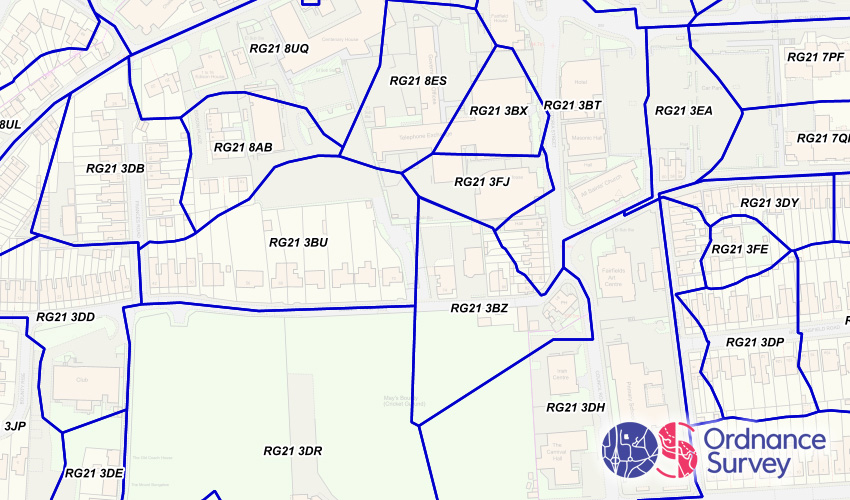
This is a layer showing the shape of every postcode unit in Great Britain.
Where does it come from?
Ordnance Survey
How often is it updated?
The whole dataset is updated every quarter.
What area does it cover?
Great Britain
How might you use it?
Whilst Parish Online includes a full address database, it's sometimes useful to see the area that one postcode covers, and how dense the postcode distribution is. One postcode can cover quite a large area in rural areas, whereas one postcode might cover just one block of flats in an urban area.


Data Licence
Provided under the Public Sector Geospatial Agreement (PSGA).
Technical Blurb
This is a polygon dataset and styled to have a transparent fill and dark purple borders. A larger scales (more zoomed in) you'll also see a label displaying the postcode.
Back to Category
MORE INFORMATION