
Long Sutton and their new Village Shop
Overview
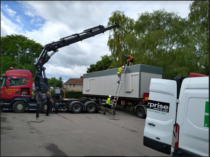
The installation of two container modules – comprising the new village shop – in the busiest part of the village hall car park (next to the primary school) – required the closing down of half the car park for a week. Installation of utilities (electricity, water, sewage) and foundations prior to the arrival of the containers meant sealing off the car park, and required new routes for parents bringing their children to school. The placing of the containers themselves involved the use of a heavy crane, and movement of all personnel was banned for the day in the installation area. The village used Parish Online to create a diagram of the restricted areas, the timetable, and the new school route, and published it on the village website via the new Public Map facility.
Challenge
To inform the villagers of the construction work – and the solutions to the problems involved - in a clear, easy-to-understand format. Matching necessarily long labels to the objects involved, with sufficient colour and highlighting to make them stand out in the overhead photograph, could not be achieved with the Label function on its own.
Solution
We created an informative map by using multiple layers within Parish Online – the underlying OS digital map; aerial photography; a polygon layer showing installation and restricted zones; a line layer showing paths for cars and children; and a points layer to provide highly enhanced labels (the Name of each point being its label) thanks to judicious use of the Style feature. The Public Map feature created a simple link that allowed the map to be published on the village website.
a) Polygon Layer:

b) Line Layer:

c) Points Layer:

The Public Map feature produces this interactive map:

Such a link is easily added to a website. Because everything is stored in the cloud, the link is ready to produce the picture whenever clicked.
Benefits
Parish Online provided a simple and effective way for the council to plan the installation of the shop and to inform the residents of the safety arrangements. Parish Online will also store these plans in a permanent digital archive so that they are available to the council for future reference.
About Long Sutton Parish Council
The Parish of Long Sutton is situated in the heart of Somerset, bordered to the south by the Levels and the river Yeo and to the north by rolling hills and woods. The Parish contains the village of Long Sutton and the hamlets of Knole and Upton.
All pictures sent to us by Long Sutton Parish Council.
Back to Category
MORE INFORMATION