
Listed Buildings
What is it?
The Listed Buildings layer displays points on the map representing buildings that have been given Listed status.
Listing marks and celebrates a building's special architectural and historic interest, and also brings it under the consideration of the planning system, so that it can be protected for future generations.
The older a building is, and the fewer the surviving examples of its kind, the more likely it is to be listed.
The general principles are that all buildings built before 1700 which survive in anything like their original condition are likely to be listed, as are most buildings built between 1700 and 1850. Particularly careful selection is required for buildings from the period after 1945. Buildings less than 30 years old are not normally considered to be of special architectural or historic interest because they have yet to stand the test of time.
Where does it come from?
Historic England
How often is it updated?
Weekly
What area does it cover?
Great Britain
How might you use it?
These datasets may be useful for:
- checking the listed status of a property
- assessing proximity to listed buildings in planning applications
Data Licence
Contains Ordnance Survey data
Technical Blurb
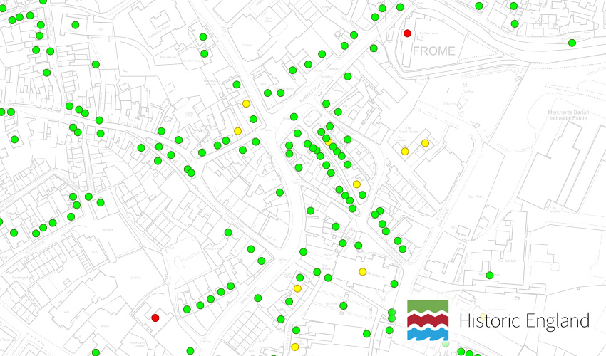
This is a point layer so a listed building is represented with a single point on the map rather than a polygon. Points in the layer are coloured red, green and yellow representing grade I, II and II* respectively.
Info click a point to see more information about the property. This includes a hyperlink to the Historic England website where comments and more information can be found.
It sometimes groups rows of houses that are all listed into one point, which may be misleading, so be sure to check with your Local Authority if you think there is a 'generalisation'.
Back to Category
MORE INFORMATION