
Indicative Radon Levels
What is it?
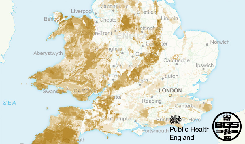
This dataset is the Indicative Atlas of Radon in Great Britain. It's an overview of the results of detailed mapping of radon potential, defined as the estimated percentage of homes in an area above the radon Action Level.
The Indicative Atlas of Radon in Great Britain presents a simplified version of the Radon Potential Dataset for Great Britain with each 1-km grid square being classed according to the highest radon potential found within it, so is indicative rather than definitive.
Where does it come from?
Jointly produced between the British Geological Survey (BGS) and Public Health England.
How often is it updated?
There may be updates made by BGS and PHE, but consider it a static dataset.
What area does it cover?
Great Britain
How might you use it?
This data can be used to get an indication of radon levels in an area. This might be relevant information to refer to when conducting neighbourhood plans or in planning issues. As this is only an indicative data, it's recommended to consult a professional should more information be needed.
Data Licence
Data derived from BGS and Public Health England.
Technical Blurb
These layers are streamed directly from BGS and are not compatible with Info Click (we're working on this).
Back to Category
MORE INFORMATION