
Green Belt Land
What is it?
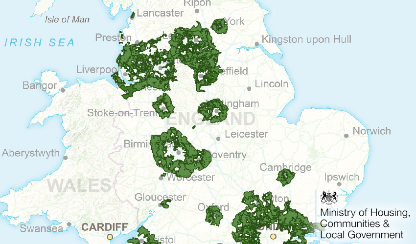
Green belts are a buffer between towns, and between town and countryside. The green belt designation is a planning tool and the aim of green belt policy is to prevent urban sprawl by keeping land permanently open; however, there is not necessarily a right of access there. There are 14 green belts in England and 1 in Wales. (Source: Open Spaces Society)
Where does it come from?
Compiled by MHCLG.
How often is it updated?
Every year. Typically around November, but this can vary.
We keep each year's green belt dataset, so you can switch multiple layers on to see change from previous years.
What area does it cover?
England and Wales
How might you use it?
This dataset might be used for:
- Checking if a property is within a Green Belt area
- See how Green Belt has changed/increased/eroded year-on-year.
Data Licence
Creative Commons
FAQs
Can I change the colour of the green belt?
No, read-only layers do not have style change options. Also, green belt is green! However, a nice trick is to use the fading slider, found under the cog mini menu for each layer so you can see the change between each year). An idea might be to have the previous year as a lower intensity green.
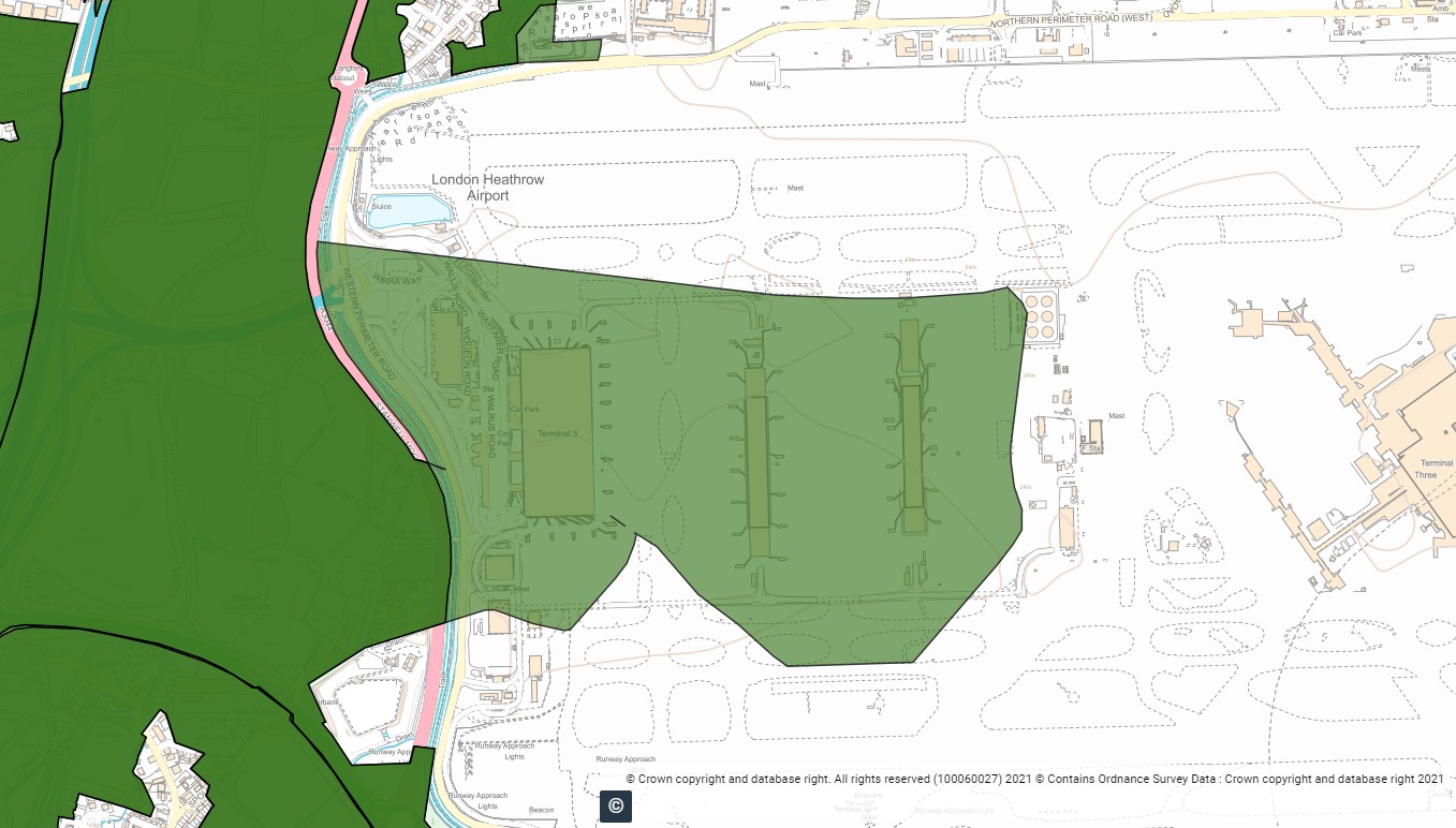
Tell me something fun about green belt!
That's not a question, or even frequently asked, but ok. Did you know that Heathrow Terminal 5 was once green belt land? It's designation was lost between 2018 and 2019.
Back to Category
MORE INFORMATION