
Elevation Data
What is it?
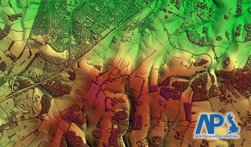
This dataset represents the elevation of the ground and surface features as a graded colour image.
Where does it come from?
the Aerial Photography for Great Britain (APGB) agreement. The data for this agreement is currently captured by a consortium of aerial survey providers (Bluesky and Getmapping).
How often is it updated?
This data is produced as a byproduct of the aerial photography captured by APGB, so it also ranges from between 6 months and 5 years old.
What area does it cover?
Great Britain
How might you use it?
This datasets is great for visualising the elevation in your area. It can help when communicating transport issues, plotting gritting routes, assessing flood implications and a variety of other tasks.
Data Licence
This data is provided under the APGB Member Licence, so to see this data in Parish Online you'll need to register for this agreement (there's a form in the Admin Panel, or upon sign up).
Technical Blurb
The height model data comprises of two layers:
- Surface Model. Shows the elevation of the ground, including any surface features like buildings, bridges, trees, or anything manmade.
- Terrain Model. Shows the elevation of the ground without any surface features (sometimes called a bare-earth model).
If you zoom too far out of these datasets then your map view may go to a rather fetching teal colour. This means there's no data available at that scale, so zoom back in and you'll see the height model again.
Back to Category
MORE INFORMATION