
Colour Infrared Aerial Photography
What is it?
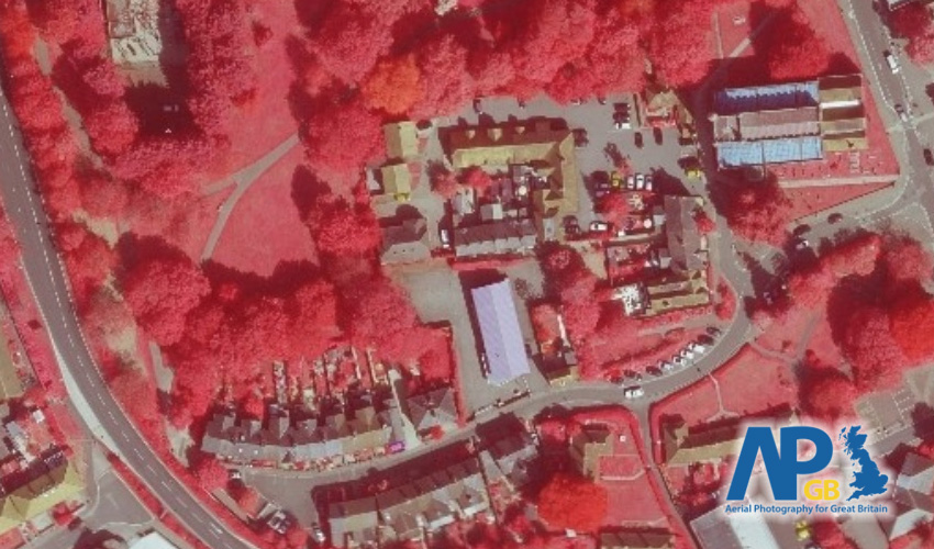
This dataset is a modified version of the aerial photography that highlights vegetation in red. The strength of the 'redness' indicates whether the camera detected a strong chloropyll response (bright red) or a weak one (faded red, close to green/grey).
Where does it come from?
the Aerial Photography for Great Britain (APGB) agreement. The data for this agreement is currently captured by a consortium of aerial survey providers (Bluesky and Getmapping).
How often is it updated?
This data is produced as a byproduct of the aerial photography captured by APGB, so it also ranges from between 6 months and 5 years old.
What area does it cover?
Great Britain
How might you use it?
This datasets is great for:
- Seeing if something is vegetation (is that green tennis court grass or green-coloured man-made material?)
- Highlighting vegetation in an area
- Getting a quick view of the amount of vegetation in urban areas (i.e. how many gardens have been converted to astroturf or paving?)
Data Licence
This data is provided under the APGB Member Licence, so to see this data in Parish Online you'll need to register for this agreement (there's a form in the Admin Panel, or upon sign up).
Technical Blurb
This dataset is produced by taking the near-infrared information captured by the camera and visualising it in the red channel of the image. That's why the non-vegetation areas look washed out, because there's no red in it.
If you zoom too far out of these datasets then your map view may go to a rather fetching teal colour. This means there's no data available at that scale, so zoom back in and you'll see the height model again.
Back to Category
MORE INFORMATION