

Barnham and Eastergate Parish Council Create their Neighbourhood Plan
Barnham and Eastergate Parish Council have proved that producing a Neighbourhood Plan doesn't have to be difficult.
Originally Barnham and Eastergate used Parish Online mainly to produce maps for inclusion in parish documents. However when it came to revising their neighbourhood plan during 2020/21 they used the new facilities available in the product to produce interactive maps for the public to be able to fully see and understand the issues being discussed.
“We would recommend Parish Online to every local council. We've saved so much time and have been able to use several tools within the software to help out our Parish."
Alison Crabb, Clerk to Barnham and Eastergate Parish Council
Approach
By creating map layers Barnham and Eastergate were able to plot and record information vital in their Neighbourhood Plan. These maps included:
Proposed New Areas of Special Character
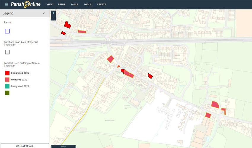
Alison used a polygon layer to show where the Proposed New Areas of Special Character are. She then colour coded these areas based on their status, which is shown in the legend in the left hand panel.
Conservation Areas
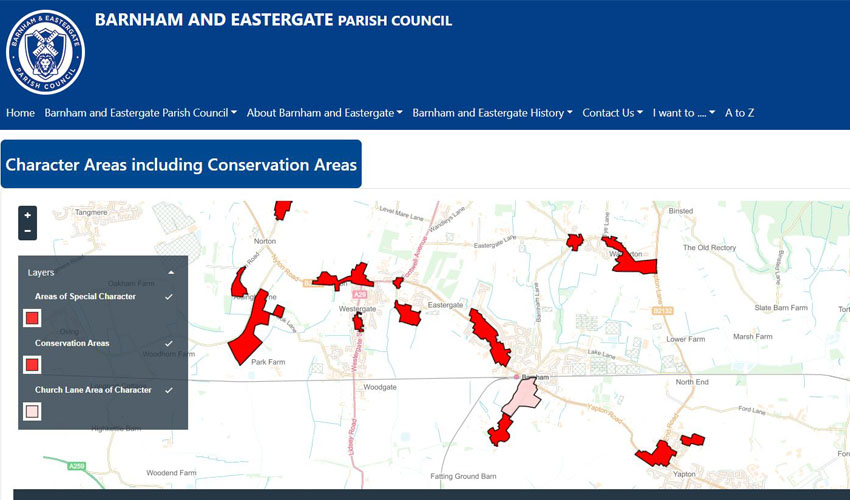
Similarly, Alison and her team used a polygon layer to upload the Conservation Areas within Barnham and Eastergate. By using the Public Map tool in Parish Online they were able to upload an interactive map to their website so the public could also view this information.
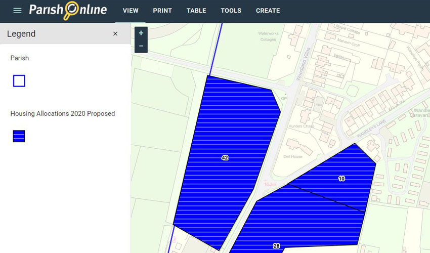
Sites Proposed for New Developments
Drainage and Sewage
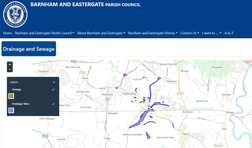
The parish suffers from historic and ongoing flooding and drainage issues. The Parish Council used the mapping tools to produce map layers showing the location of each event and has recorded the details for each location. This provides a useful repository which is used when reviewing planning applications. There are plans to add photographic records to each attribute.
Results
- Improved public engagement
- Taking advantage of other tools within Parish Online to make parish tasks easier
- An on-hand repository, which can be used when reviewing planning applications
Tools Used
About Barnham and Eastergate
Barnham is a small rural parish within the Arun district and lies between the South Downs and the sea covering an area of approximately 373 hectares. It has a population of 1465 and contains around 580 residential properties.
Commercial activities in the parish are mainly related to agriculture and horticulture but also include a touring caravan park and a cluster of small retail units at Parsonage Farm beside Barnham Windmill. The parish contains several properties of architectural merit, the most imposing of which is Barnham Court; parts of the former Portsmouth to Arundel canal; and many miles of public footpaths.
All pictures sent to us by Barnham and Eastergate Parish Council.
Back to Category
MORE INFORMATION