

During the heat of the last few weeks we've been making some updates to Parish Online based on some of your feedback and requests.
Here are some of the latest updates.
New Ordnance Survey datasets added
We've added:
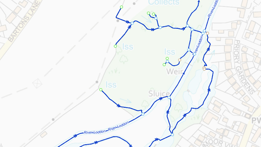
- OS Open Greenspaces (which highlights access points and boundaries for things like Golf Courses and Play Areas),
- OS Water Network (which shows water courses and flow direction),
- OS Open Terrain 50 (which show generalised contours and spot heights).
This data is already embedded into some of the Ordnance Survey base maps, but this gives you the opportunity to switch them on as their own layer. This might be useful if you're trying to highlight something in particular; where your green spaces are, for example.
You'll find these new layers in Collections in the left-hand panel in Parish Online. Use the search tool if they're not immediately obvious.
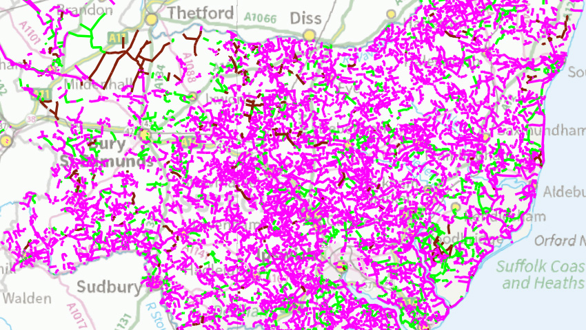
More Local Authority data added
© Crown copyright and database right. All rights reserved (100060027) 2019
We've added lots more data from Local Authorities, including from Cornwall, Suffolk and Bradford. We do this when there are map datasets that are specific to a certain area, or where the dataset is split up around the country (like Public Rights of Way).
As ever, if you want to see your Local Authority add data into Parish Online, let us know and we'll try to source it and get it loaded. You can always help by contacting your Local Authority yourselves and asking to have datasets put into Parish Online.
Class Name override for Map Layers
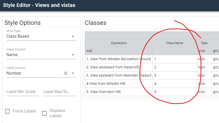
Applying a class-based style is a great way to show different types of information within one Map Layer, e.g. to show different building types. We use this for our address points layer where residential buildings are red points and commercial buildings are blue points.
However, when printing maps with a legend you can often end up with messy or long names for your classes. So we've implemented a feature in the styling tool where you can override the names; so you can set "Residential Class Building" to simply "Residential". It'll look a lot cleaner in the printout.
You can find this feature in the styling tool when a class-based style is selected. It'll show a column called 'Class Name' where you can enter your override style.
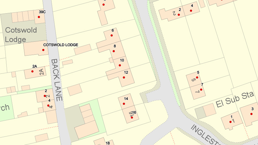
Address labels added
© Crown copyright and database right. All rights reserved (100060027) 2019
A lot of you asked to see the names and numbers of address points when you were zoomed in on the map. This month we've updated that layer to do exactly that. So when you're zoomed into a neighbourhood you'll see the name or number as a label next to the address point.
This will help you identify the exact house number without having to Info Click each one. We hope you'll find this useful and make the map more informative.
That's all for this edition. Look out for more updates on our website, on twitter or through our newsletter.
Thanks,
The Parish Online team