
We have teamed up with Skeye who are industry leaders in Aerial Imagery capture to provide low cost, up-to-date ortho imagery and 3D Models across the UK.
![]()
Why is imagery important for a Town, Parish or Community Council?
Aerial Imagery (also known as Ortho Imagery) is a great resource for your Council, providing detailed up-to-date information about what is on the ground and can be used to support a whole range of activities including:
- Neighbourhood Development Plans
- Emergency Plans
- Plotting & Maintaining Assets
- Managing open spaces & environmentally sensitive areas
- Tracking development and land use changes
- Managing grounds maintenance contracts
With Skeye's ultra modern capture technology they can capture data at a lower altitude than conventional aerial photography systems. This enables them to produce much higher resolution imagery than you will have seen in Parish Online before (<5cm compared to 12.5 or 25cm depending on the year of capture and your area), giving you a much higher level of detail.
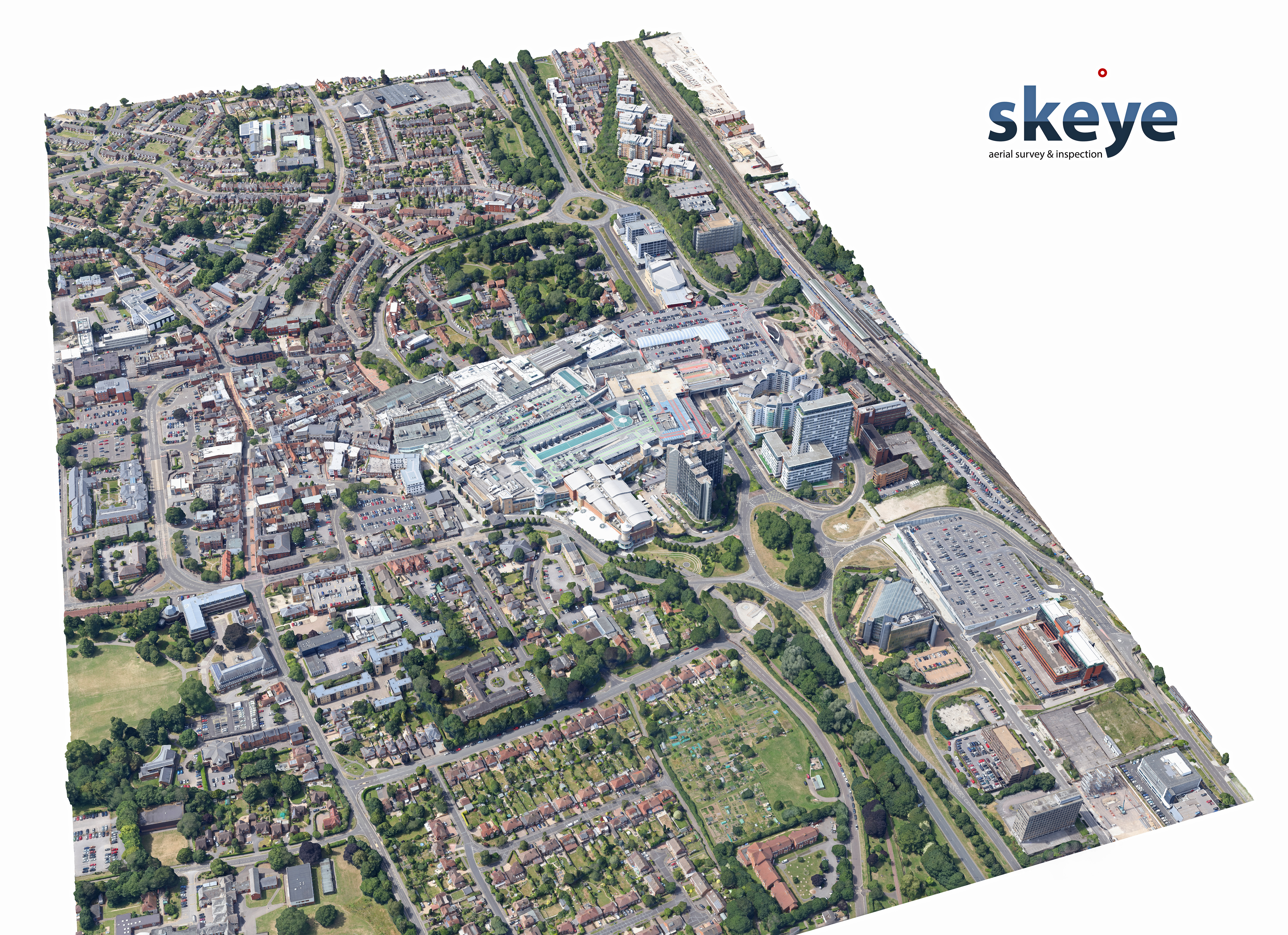
Here's a few examples of 3.5cm Aerial Imagery captured in Basingstoke in September 2017.
You can find out more about Aerial Imagery in this article by GeoXphere (the company that brings you Parish Online).
As well as capturing new Aerial Imagery, Skeye's technology along with the flight pattern they use enables them to also produce a photo-realistic 3D model at the same time that can be delivered within the same cost. You might not have thought about using 3D in your council before, probably due to cost or perceived complexity, but it is now more affordable than ever and easy to use. Some of the major benefits that 3D gives you over standard Aerial Imagery include:
- Ability to see the terrain (lie of the land)
- Viewshed analysis (working out what can be seen from a particular point), this is great for analysing planning proposals
- Sunlight & Shadow analysis
- Measuring the heights of Buildings, Trees, Walls
- Promotional Videos & Images
- Road Gradients - to work out which roads areas are most vulnerable in wet or winter conditions.
See a 3D model in action here
Captured and delivered within weeks
Ensuring the information you use to make decisions, capture evidence and manage your business is up-to-date is pivotal in enabling you to be effective and efficient. One of the major benefits of Skeye's capture process is that there's now no need to wait for months or years even to receive your new data. Flying at lower altitudes enables Skeye to capture under the cloud line, increasing the number of days they can capture imagery on compared to traditional techniques. This means they can turn around your order for high resolution imagery and 3D model within weeks and you can get more regular updates as/when you require them. For example having both Summer (leaves on trees) and Winter (no leaves) Imagery can often be really useful, or having a historic record over a number of years to see how development is changing the area you manage.
How much does it cost?
Data can be captured anywhere in the UK. The first square kilometre costs £1,500 then £250 for every square kilometre thereafter (assuming all the data can be captured in a single day). If you are a small Parish, or only require a small area of your Parish to be flown then why not team up with neighbouring Parishes, Businesses or Organisations to share the costs? You can use Parish Online to measure out the area you want captured and provide us with a map (in PDF) to show the area, we can then quickly confirm the costs and start planning the flight to capture your data.
All data that is captured can be delivered in a number of different formats to fit your GIS/CAD requirements at no extra cost. Aerial imagery can also be loaded into your Parish Online account so you can use it alongside your existing datasets and information.
Order new imagery today
To discuss getting new imagery and a 3D model of your Parish contact Carl Greenman at This email address is being protected from spambots. You need JavaScript enabled to view it.