

The new National Allotment Map in Parish Online is a new information sharing initiative between local councils and the National Allotment Society.
Why have we started the National Allotment Map?
The Parish Online team started talking to the National Allotment Society during lockdown in the Summer of 2020. The discussion highlighted the lack of consistent mapping and reporting across the country with regards to allotments. Allotments are as important as ever to ensure people have an outdoor space to get into gardening, educate younger generations about food production, engage with nature, improve mental health and ultimately bring communities together. With new-build houses being given smaller and smaller gardens, provision of allotment space is an important step to realising these benefits.
By using the power of Parish Online's collaborative editing tools, the team set about creating a new collaborative map.
What is the National Allotment Map?
The National Allotment Map is a pre-configured editable layer now available to every Parish Online user. Each Local Council can log into Parish Online and update information about local allotments, add ones missing from the database, and mark locations for potential new allotment sites. By making these small contributions it will help build up an accurate national picture of allotments around the country.
The aim of this collaborative map is to compile accurate local information about the location, utilisation and on-site facilities of allotments. By harnessing this local knowledge, Local Councils can benefit by using the map in their own reports and consultations, and the National Allotment Society will benefit by using the map to help with their guidance and promotion of allotments. As a result, we’ll end up with the most accurate and detailed map on allotments ever created.
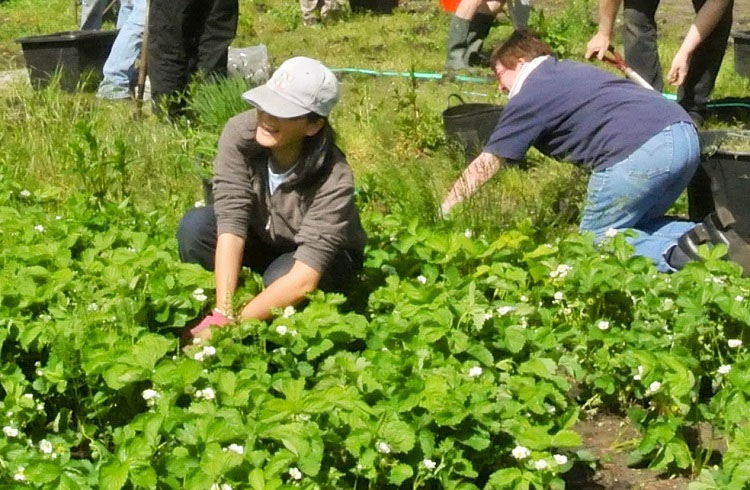
Communities coming together in allotment gardens (© NSALG)
Contributing to the Map
To get started contributing to the map, simply log into Parish Online, find the layer and start editing. Detailed guidance can be found below and in our Knowledge Base.
To contribute to the National Allotment Map, log into Parish Online, find “National Maps” in the left-hand layer control, expand it and switch on “National Allotment Map – Boundaries”. The map will already have some information showing allotment site boundaries, but some may be missing. So simply use the editing tools in Parish Online to make edits to existing boundaries or create new ones. Be sure to include as much information about the site as you can. There are handy drop-down options for most fields, making it quick and easy to enter information consistent with your Local Council peers.
Please note that in the “National Allotment Map – Boundaries” layer you should only draw the full site and not individual plots. You can use the “National Allotment Map – Plots” layer for adding individual plots. We have set permissions for both layers to ensure you can use the new layers without exposing any personal data;
- Information stored in the Boundaries layer will be visible and editable by any Parish Online user
- Information stored in the Plots layer will only be visible and editable by users of your Parish Online account. So you can safely add details of plot tenants without exposing their details to others.

Expected Benefits
The National Allotment Map is designed to benefit every local council in their own right. Allotment sites can be updated with up-to-date information and then simply sits there ready to be used as a resource for later on. This saves each local council time and effort when it comes to recalling information about allotment holdings. However, each update made to the map contributes to a bigger picture that any local council can see, as well as key members of the National Allotment Society.
Expected uses and benefits include:
- Local Councils having a reliable and information-rich dataset available to them for their council work
- Local Councils can better see where there are gaps in the provision of allotment land
- National Allotment Society can view the map to see which parts of the country have good or bad provision and set about making recommendations
- Local Authorities can get involved to share their information and benefit all.
Next Steps
The National Allotment Map is ready to be used in your Parish Online account, so log in and start making additions to the map! If you don't have a Parish Online account, you can sign up to a 30 day free trial. This map will evolve over time to make it even more usable and useful for all involved.
If you have any suggestions for improving the map or how it's structured we'd love to hear from you. Email us at This email address is being protected from spambots. You need JavaScript enabled to view it..
We'd also recommend becoming a member of the National Allotment Society to get benefits such as access to initial legal advice on a range of issues e.g. tenancy agreements, leases, land disputes, rent rises, health and safety, environmental, contract and company law and data protection. Find out more about becoming a member here.