
Coal Authority
What is it?
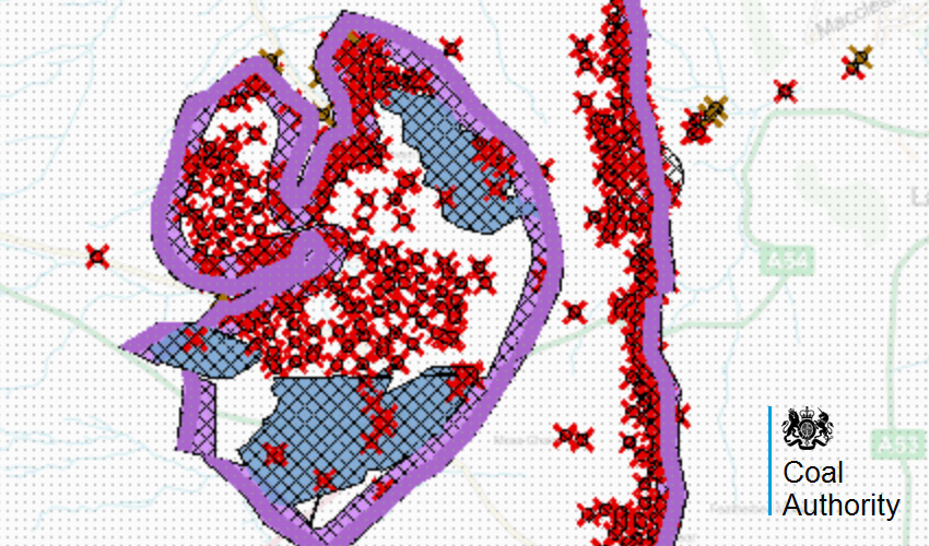
This is a collection of layers made available by Coal Authority showing a various coal mining information from their vast database.
The collection includes:
- Coal Mining Reporting Area - Dataset showing extent of coal resources capable of being extracted by surface mining methods.
- Coal Outcrops - Dataset showing known locations where a coal seam is near the surface.
- Development High Risk Area - Dataset showing part of the coal mining reporting area which contains recorded coal mining related features.
- Fissures and Breaklines - Dataset showing types of geological disturbances which may have been affected by coal mining.
- Mine Entry - Dataset showing known mine entries indicating the entrance into a mine working.
- Mine Entry Potential Zone of Influence - Dataset showing the area of the ground that might be affected if subsidence a mine entry occurs.
- Past Shallow Coal Mine Workings - Dataset showing underground coal workings whose depth is 30 metres or less from the surface.
- Probable Shallow Coal Mine Workings - Dataset showing likely extent of shallow underground coal workings for which no recorded plans exist.Surface Mining (Past and Current) - Dataset showing areas of coal extracted by surface excavations in the past or currently being excavated
Where does it come from?
The Coal Authority
How often is it updated?
Data in these layers are a snapshot from 11th April 2018. There may be further updates, but consider it a static dataset.
What area does it cover?
Great Britain
How might you use it?
These datasets may be useful for:
- finding out if a property is in an area affected by coal mining
- checking if an area is in a high risk area
- seeing where there are coal and mine entries on or near the surface.
Data Licence
Provided through Open Government Licence (V3).
Technical Blurb
These layers are streamed directly from The Coal Authority so if the loading of the data is slow or broken then please let us know but please don't blame us!
The data is 'zoom restricted' so some of the layers will disappear if you zoom too far out, or too far in. This means you won't be able to zoom into property level. The reason for this is the data isn't that accurate and The Coal Authority don't want you misinterpreting it.
If you need more detailed information then we can put you in touch with 'coal professionals' at The Coal Authority who will be able to help.
Back to Category
MORE INFORMATION